This metro route map shows how to travel from AEC Metro Station to Shreyas Metro Station using the Ahmedabad Metro. It includes the complete route map, platform details, total distance, travel time, interchange stations, fare information, and entry and exit gates. You can also check first and last metro timings to plan a smooth and convenient journey.
Fastest Route (22 Minutes) Via Red Line
10 Stations
Direct Route
₹15
10 Stations
Direct Route
₹15
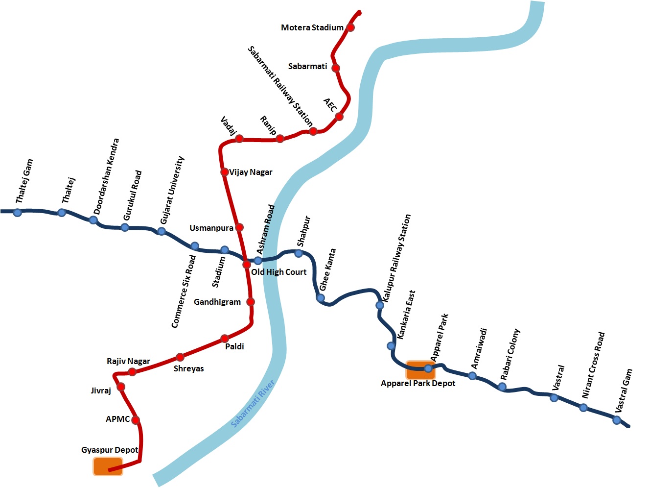
AEC
Sabarmati Railway Station
Ranip
Vadaj
Vijay Nagar
Usmanpura
Old High Court
Gandhigram
Paldi
Shreyas
AEC to Shreyas Metro Route Details
AEC to Shreyas Metro Route Summary
AEC Metro Station Entry & Exit Gates
Entry and exit gate information is currently not available for this station. We are working to update this information.
Shreyas Metro Station Entry & Exit Gates
Entry and exit gate information is currently not available for this station. We are working to update this information.
Ahmedabad Metro Network Overview
Find essential details about the Ahmedabad Metro Network, including operational information, train timings, network scale, and key contact details. This overview helps you quickly understand the system before planning your journey.
Launched Year
2019
Total Lines
4+
Total Stations
49+
Train Length
3 Coaches
First Train
6:20 AM
Last Train
10:00 PM
Operator
Gujarat Metro Rail Corporation
Owner
Gujarat Metro Rail Corporation (Joint Venture of Government of India and Government of Gujarat)
Helpline
+91-79-22960123
Ahmedabad Metro Network Map 2026
View the latest Ahmedabad Metro Network Map (2026) with all operational lines and stations. The map shows line colors, station sequence, and interchange points to help you understand the network layout and plan your journey more efficiently.
Click to view full size
Frequently Asked Questions
The travel time from AEC to Shreyas is approximately 22 minutes.
The distance between AEC and Shreyas is approximately 10.3 kilometers.
No interchanges are required. This is a direct route on a single metro line.
The metro fare from AEC to Shreyas is ₹15.
Exact fare may vary based on the type of token or card used and the time of day (peak or off-peak).
The route from AEC to Shreyas uses the following metro line: Red Line.
MetroYatra shows a detailed map and train direction at each interchange.
The route from AEC to Shreyas takes around 22 minutes via Red Line.
Route Details:
• Duration: ~22 Minutes
• Distance: ~10.3 Kilometers
• Interchange: No Interchanges (Direct Route)
• Fare: ₹15
• Metro Lines: Red Line
Note: Routes are sorted by shortest path first, then by fewest interchanges. Travel times are estimates and may vary based on actual metro schedules.
Found incorrect information? Help us improve!