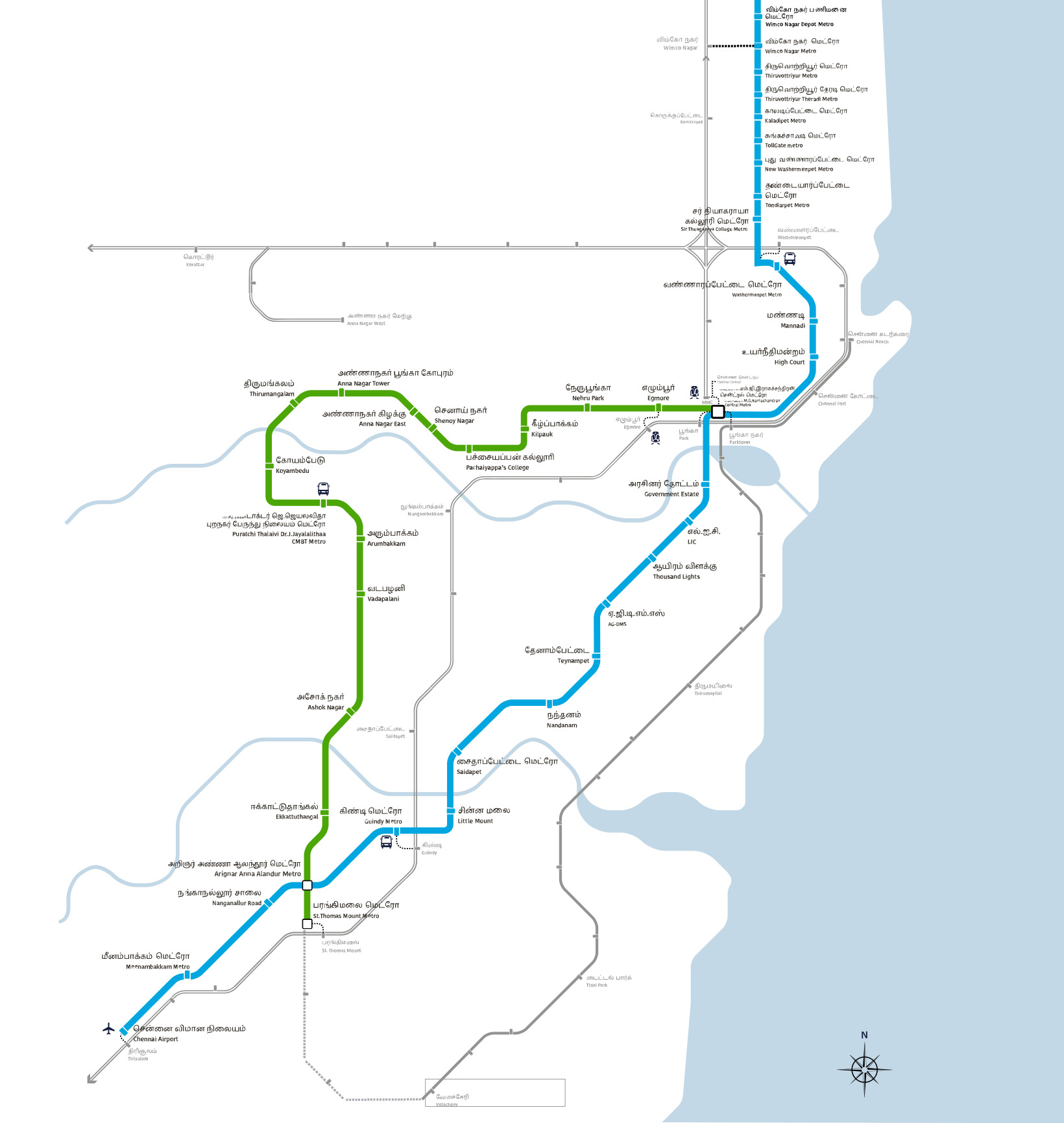
Chennai Metro is Tamil Nadu's rapid transit network, operated by Chennai Metro Rail Limited (CMRL), a joint venture of the Government of India and the Government of Tamil Nadu formed in December 2007. Phase I runs 41 Chennai Metro stations across 2 colour-coded lines spanning about 54.65 km, with trains operating daily from roughly 5:00 AM to 11:00 PM.
The Blue Line (Wimco Nagar Depot–Chennai International Airport, 26 stations, 32.65 km) and Green Line (Puratchi Thalaivar Dr. M.G. Ramachandran Central–St. Thomas Mount, 17 stations, 22.00 km) meet at two interchange stations: Puratchi Thalaivar Dr. M.G. Ramachandran Central, next to Chennai Central railway station, and Arignar Anna Alandur in the south. Together the two lines connect Chennai International Airport and the southern IT corridor around Guindy to the historic core around Chennai Central, Egmore, and Anna Nagar, with Blue Line trains extending north to Tiruvottriyur and Wimco Nagar.
Chennai Metro fare is zone-based, rising with distance, and the Singara Chennai Card (Chennai's National Shared Mobility Card) gives a 20% discount over QR-code single-journey tickets. Peak-hour trains on busy stretches like Airport–city centre run as often as every 3 to 6 minutes. The CMRL helpline is 1860-425-1515. MetroYatra provides station-wise Chennai Metro train timings, route map, fare calculator, and platform details for all 41 stations.


