This metro route map shows how to travel from Model Town Metro Station to Rajendra Place Metro Station using the Delhi Metro. It includes the complete route map, platform details, total distance, travel time, interchange stations, fare information, and entry and exit gates. You can also check first and last metro timings to plan a smooth and convenient journey.
Fastest Route (36 Minutes) Via Yellow Line•Blue Line
14 Stations
1 Interchange
₹32
14 Stations
1 Interchange
₹32
Model Town
Guru Teg Bahadur Nagar
Vishwavidyalaya
Vidhan Sabha
Civil Lines
Kashmere Gate
Chandni Chowk
Chawri Bazar
New Delhi
Rajiv Chowk
Rajiv Chowk
Ramakrishna Ashram Marg
Jhandewalan
Karol Bagh
Rajendra Place
Model Town to Rajendra Place Metro Route Details
Model Town to Rajendra Place Metro Route Summary
Model Town Metro Station Entry & Exit Gates
Gate 1: Alpana Cinema
Gate 2: Tagore Park
Gate 3: Kirpal Bagh
Gate 4: Gujranwala Town
Rajendra Place Metro Station Entry & Exit Gates
Gate 1: Rajendra Bhawan
Gate 2: BLK Hospital
Gate 3: Old Rajender Nagar
Gate 4: Krishi Kunj
Delhi Metro Network Overview
Find essential details about the Delhi Metro Network, including operational information, train timings, network scale, and key contact details. This overview helps you quickly understand the system before planning your journey.
Launched Year
2002
Total Lines
13+
Total Stations
242+
Train Length
4 / 6 / 8 Coaches
First Train
5:00 AM
Last Train
11:30 PM
Operator
Delhi Metro Rail Corporation
Owner
Delhi Metro Rail Corporation (Joint Venture of Government of India and Government of National Capital Territory of Delhi)
Helpline
155370
Delhi Metro Network Map 2026
View the latest Delhi Metro Network Map (2026) with all operational lines and stations. The map shows line colors, station sequence, and interchange points to help you understand the network layout and plan your journey more efficiently.
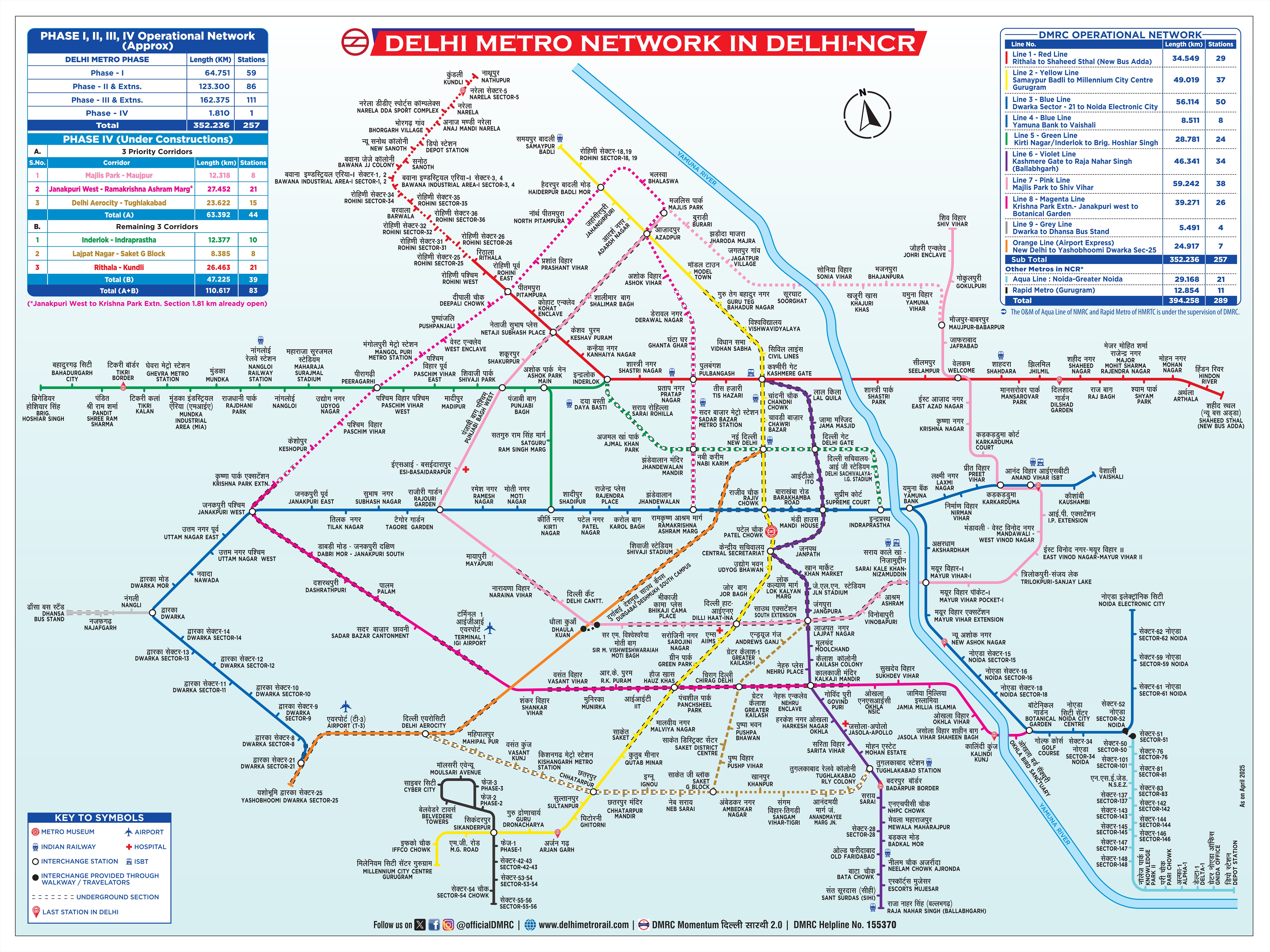
Click to view full size
Frequently Asked Questions
The travel time from Model Town to Rajendra Place is approximately 36 minutes.
This route requires 1 interchange at Rajiv Chowk.
The distance between Model Town and Rajendra Place is approximately 14.2 kilometers.
Yes, this route requires 1 interchange at Rajiv Chowk.
MetroYatra automatically highlights the interchange points and platform directions to make your journey easier.
The metro fare from Model Town to Rajendra Place is ₹32.
Exact fare may vary based on the type of token or card used and the time of day (peak or off-peak).
The route from Model Town to Rajendra Place uses the following metro lines: Yellow Line, Blue Line.
MetroYatra shows a detailed map and train direction at each interchange.
The route from Model Town to Rajendra Place takes around 36 minutes via Yellow Line•Blue Line.
Route Details:
• Duration: ~36 Minutes
• Distance: ~14.2 Kilometers
• Interchange: 1 Interchange at Rajiv Chowk
• Fare: ₹32
• Metro Lines: Yellow Line•Blue Line
Note: Routes are sorted by shortest path first, then by fewest interchanges. Travel times are estimates and may vary based on actual metro schedules.
Found incorrect information? Help us improve!